
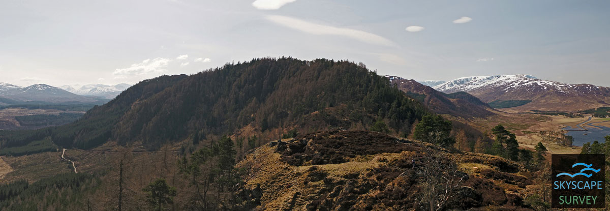
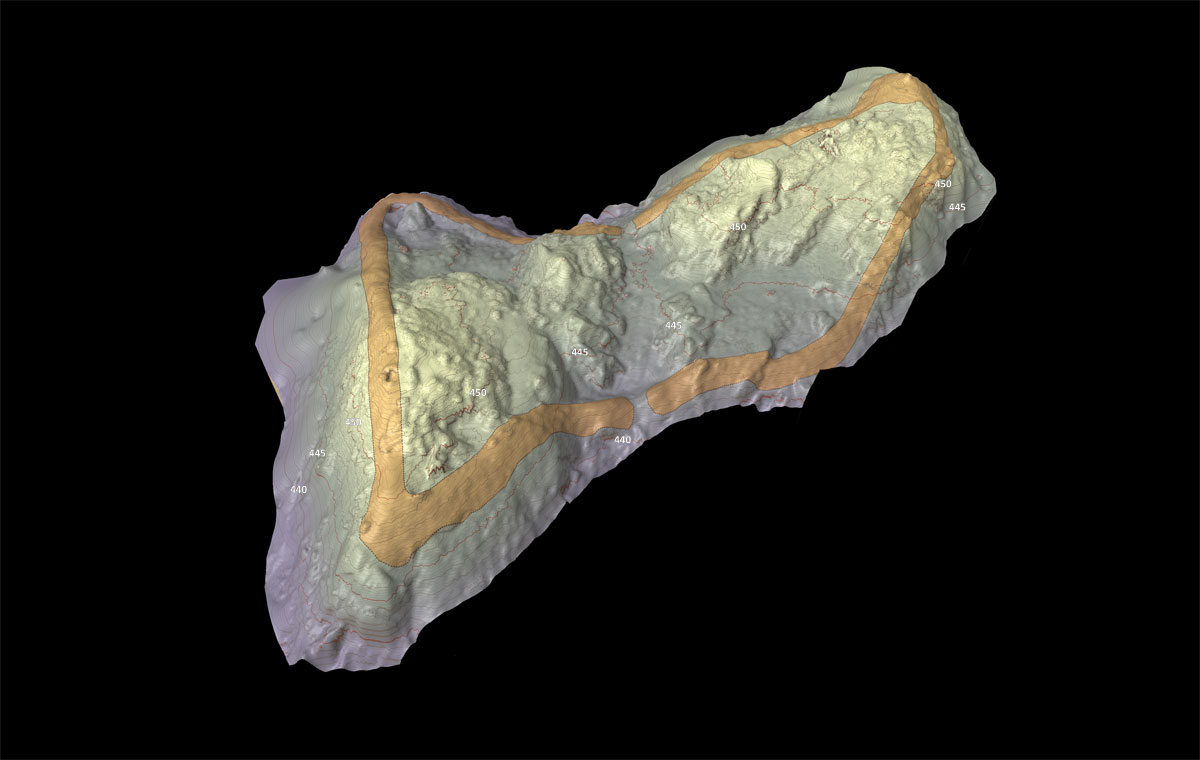
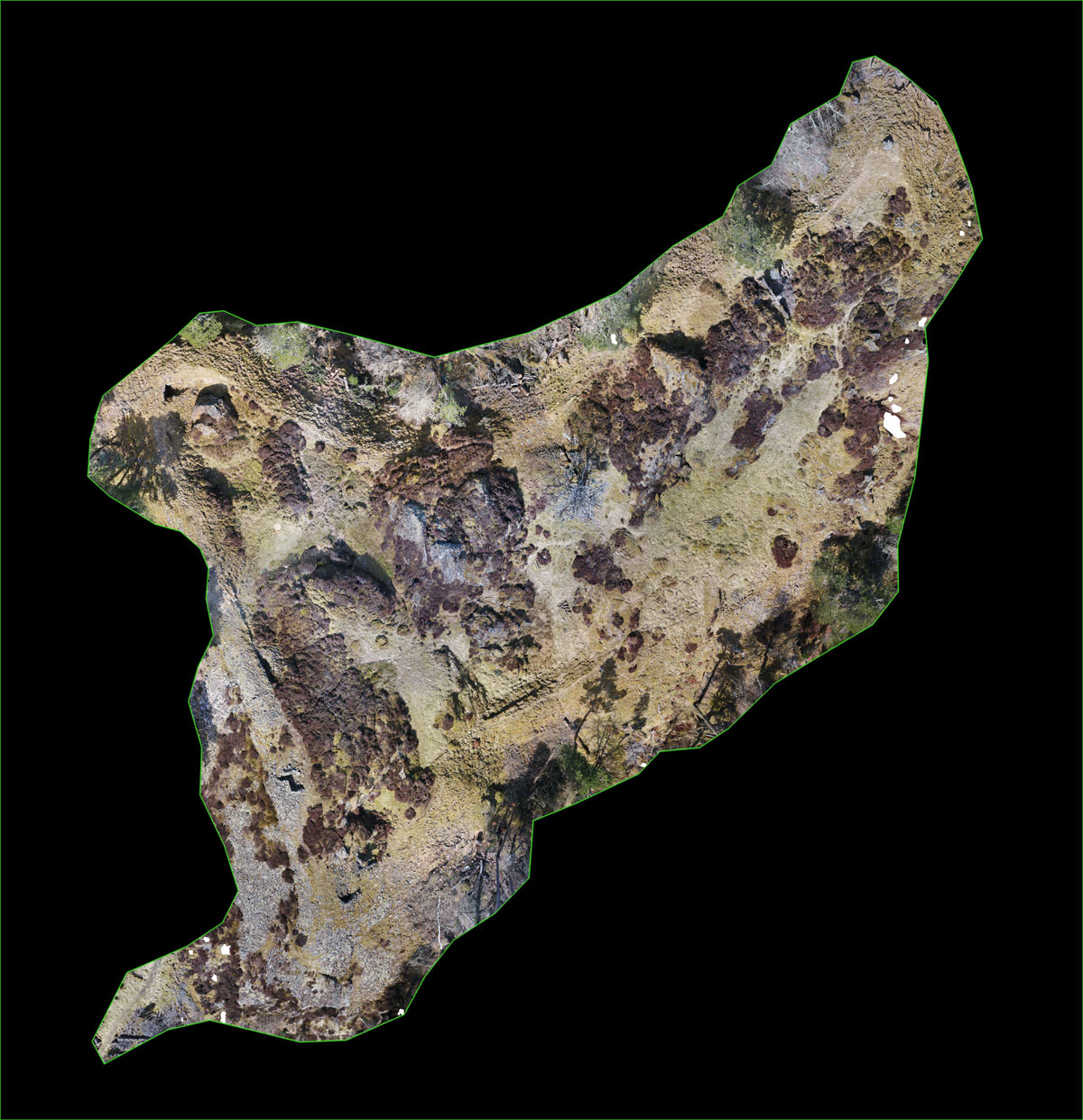
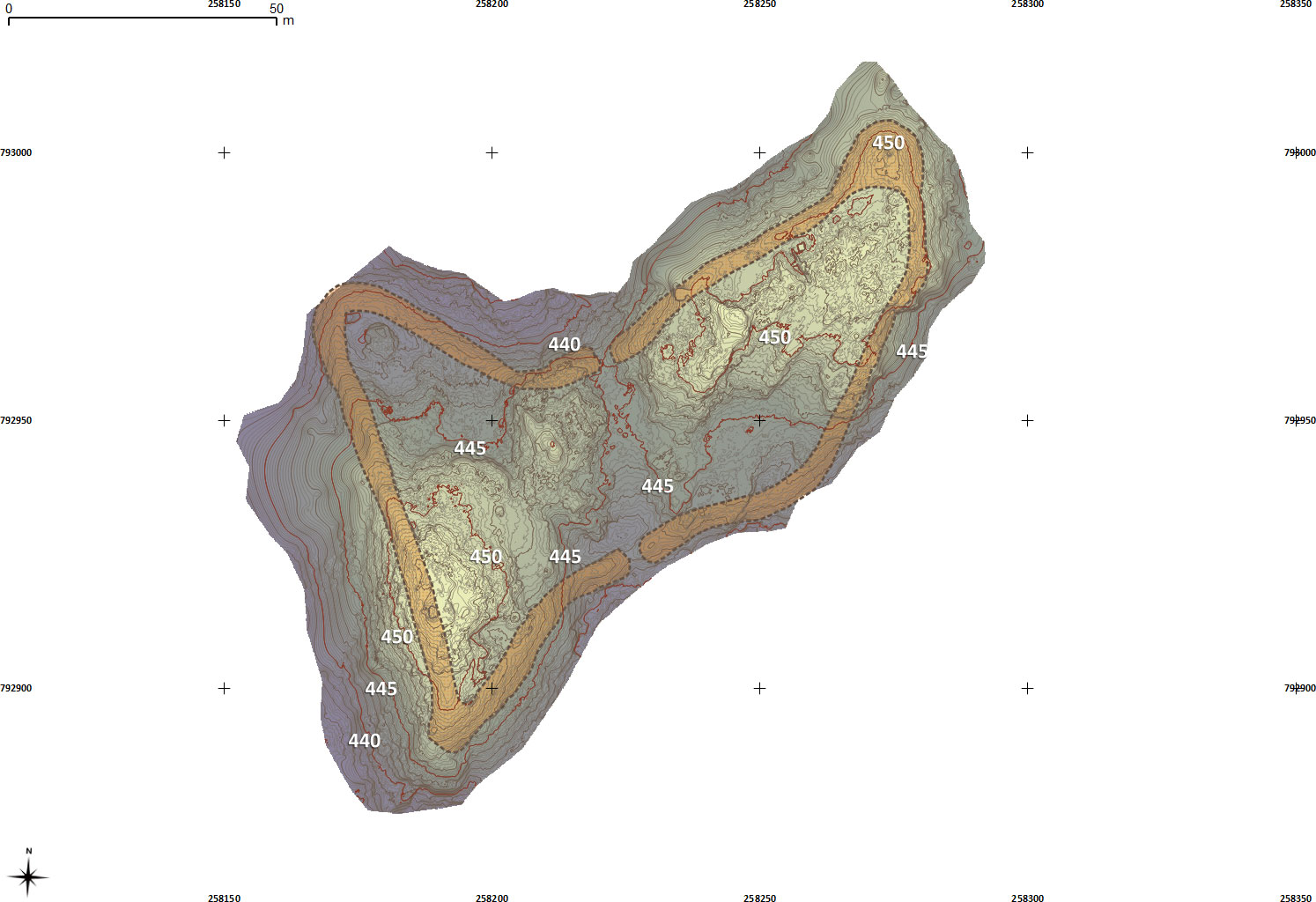
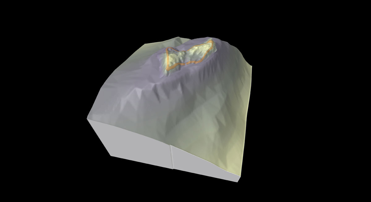
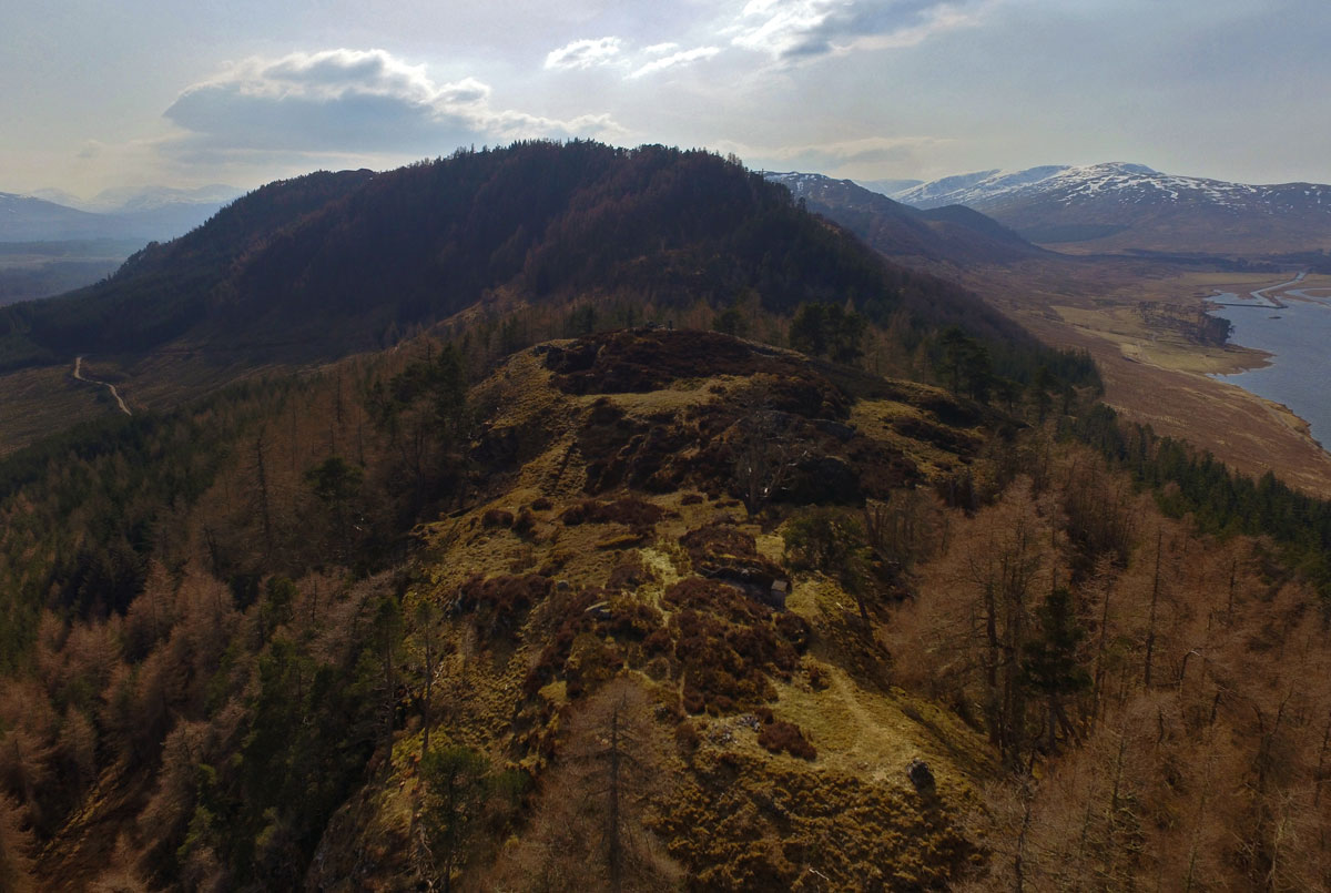
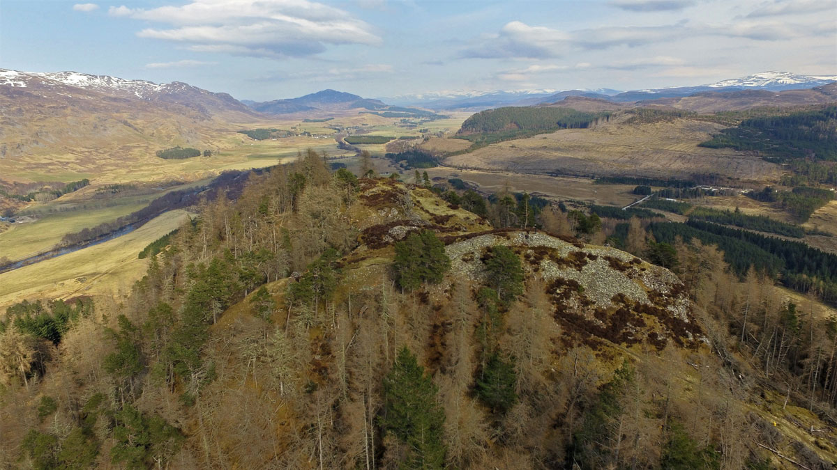
Dun da Lamh is located on a rocky hill at the north-east end of Black Craig overlooking the junction of Glen Shira and the River Spey to the north and Strath Mashie and River Mashie to the south. The interior of the fort covers an area of some 4000 square metres. It is very uneven and includes several rocky outcrops. The east and south sides of the hill are steep and include several vertical crags. The site is surrounded on all sides with high conifer plantation. Read more here: https://scotland.forestry.gov.uk/activities/heritage/prehistoric-sites/dun-da-lamh-fort
.
A topographic survey, and imaging required to understand the the site and allow for the graphic reconstruction of the monument by an artist. Aerial imaging was essential to place it into landscape context and provide a detailed survey of the site but would require careful flight planning to gather enough height data of the interior which could be geo-located and merged with public lidar data.
.