
What we do
Simply put, we use drone for different archaeological works depending on the specific requirements. Our services include aerial photography for publication, promotional material or interpretation, including creation of publication ready images in a variety of formats; photogrammetric survey and 3D imaging for site modelling, from photo-realistic modelling to contour or shaded models. We also use drone for site and structures condition monitoring, as part of heritage management process, and creation of structural plans of elevations as part of historic buildings recording (HBR). Our portfolio also includes production of short video clips for use in promotional material and landscape surveys.
Click the links below to see more about what we do!
Building Record
Often buildings and features are complexes of linked structures only revealed from birds-eye view. Whether monitoring historic buildings condition or recording inaccessible sites – miss nothing with a Skyscape controlled SUA.
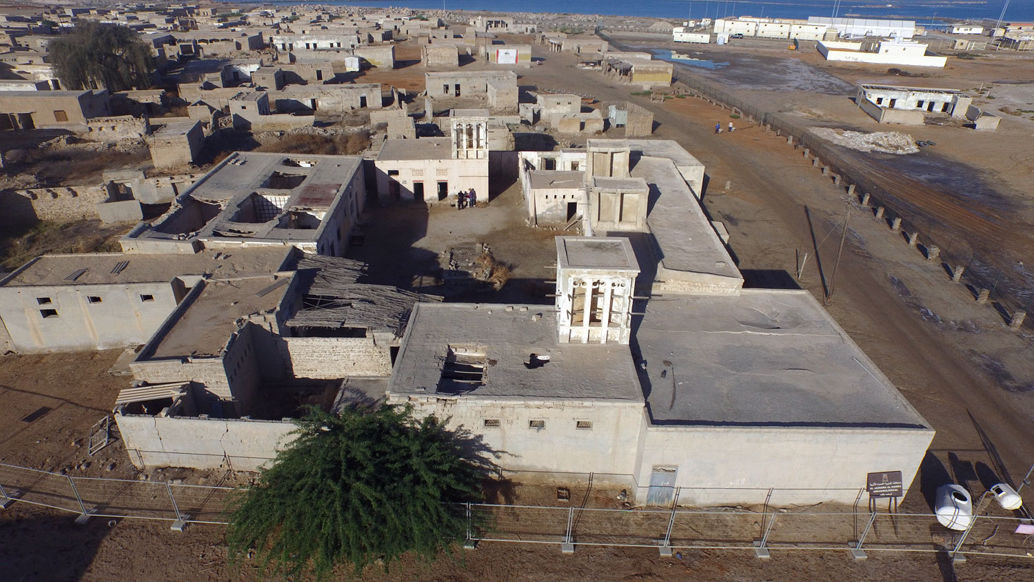
Aerial image of Abdul Kareem compound in the village of Al Jazeera Al Hamra, Ras al-Khaimah
Site Images and Video
Your site is a dynamic environment, so capture the moment as it happens, and make the most of new technology.
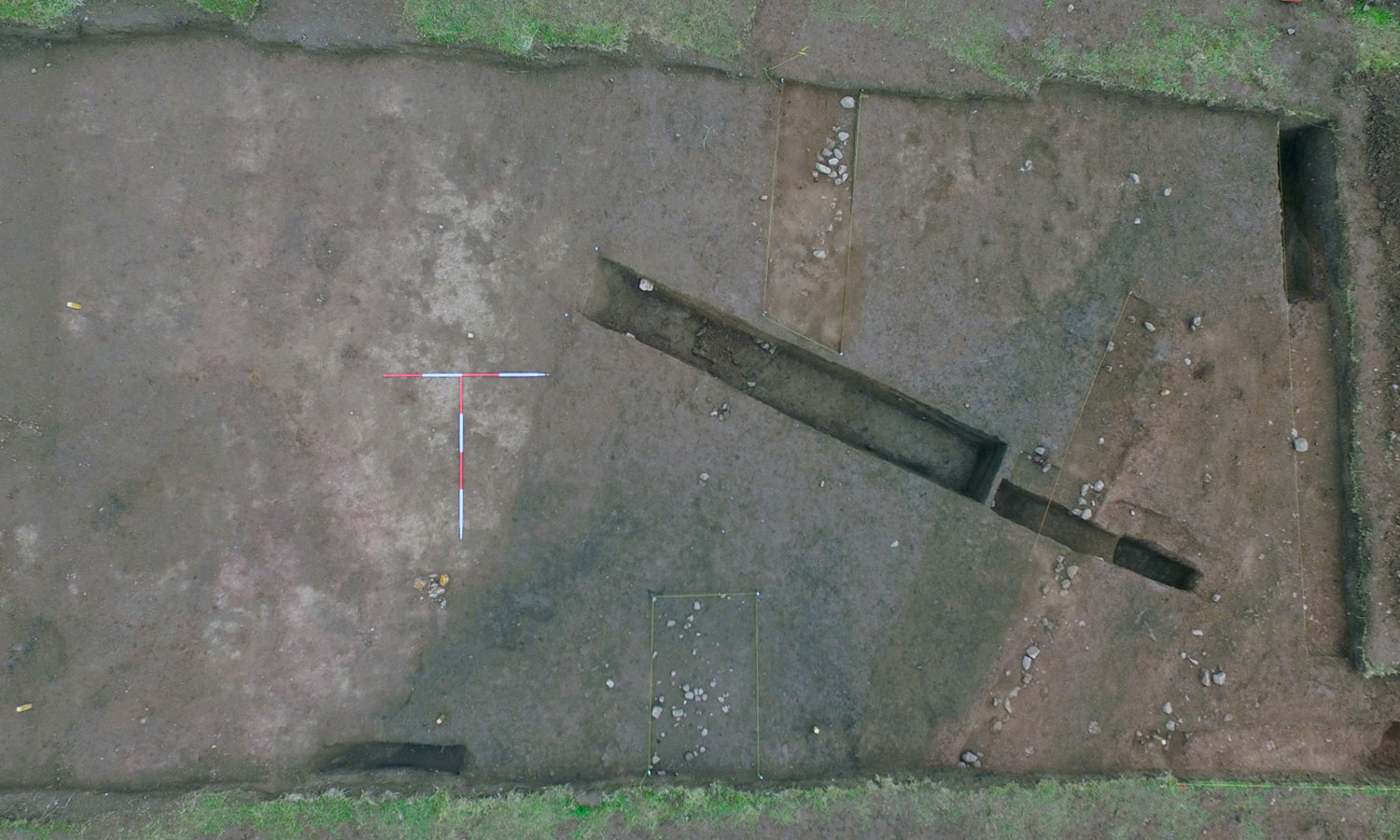
Sheriffside cropmark enclosure, East Lothian, showing complex of palisades and ditches
Topographic Survey
Survey large areas in less time than traditional terrestrial based systems with high accuracy.
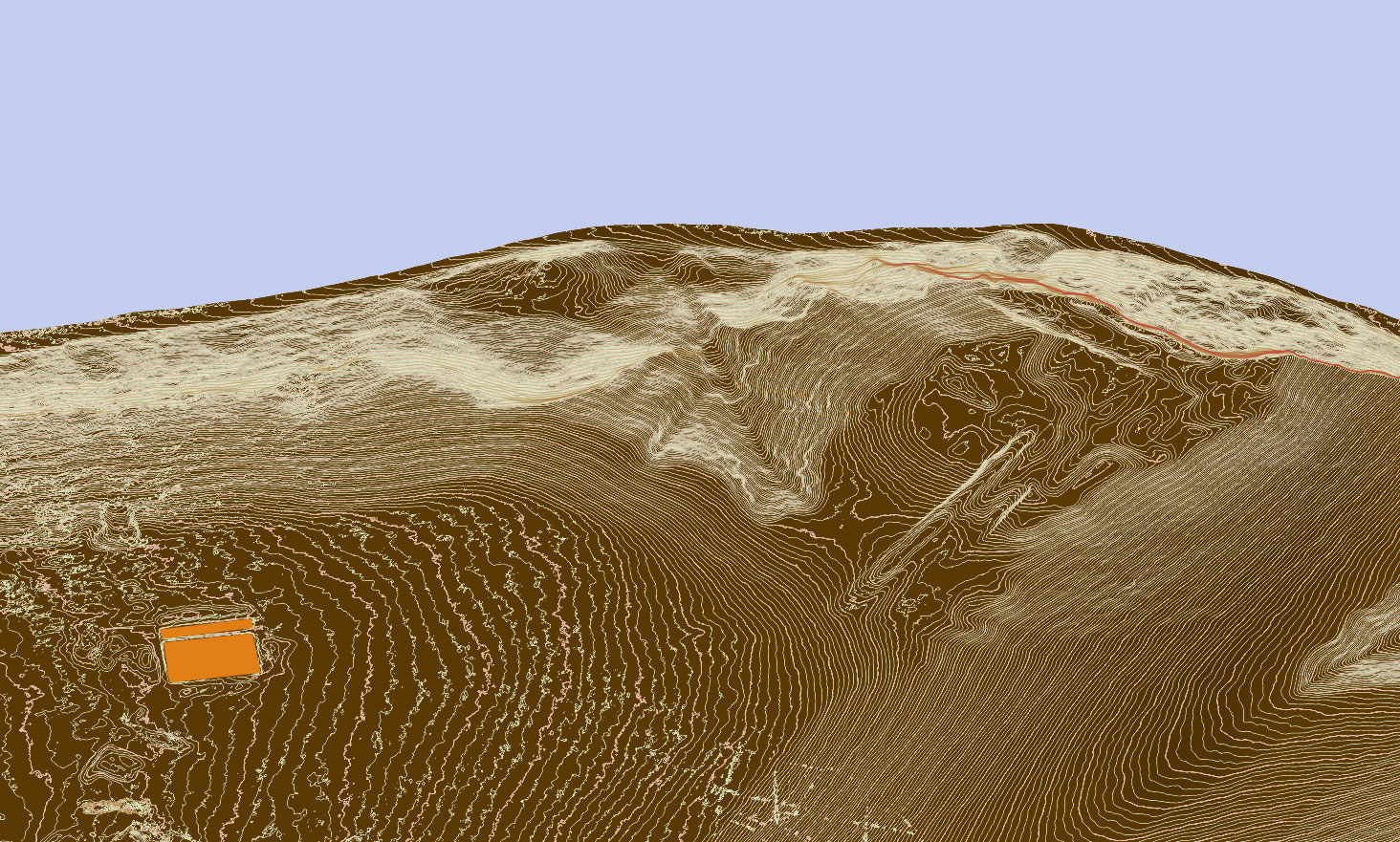
Sultana Malu Rosu, Romania- 3D contour plan derived from SfM aerial imagery